


|
| Book cover | Autor | Title | Description |
| Bild | Autor | Leer | Beschreibung |
| Date | Event | Tribe | Chief |
| About 600 AD | Trade with the Indians intensified, especially in the area of the St. Lawrence River, while trade on the east coast of what is now the USA declined. Smaller quantities now reached the Tionnontate (Wendat) in the area between present-day Toronto and Hamilton in Ontario and the later Huron (Wendat) in the area between present-day Toronto and Lake Simcoe in Ontario. Both tribes had meanwhile moved their tribal territories to the area between Lake Simcoe and Georgian Bay and were now closer to the trade routes. The Iroquois in New York State had good access to trade goods coming from the East Coast and the St. Lawrence River. | Montagnais (Innu) Iroquois Huron (Wendat) Petun (Wendat) | - |
| 3 September 1609 | Henry Hudson discovered the Hudson River when he was traveling on behalf of the Dutch East India Company. He sailed up the Hudson River to present-day Albany and then had to turn back. He brought the news to Holland that the area was suitable for trading beaver pelts. As a result, private trading missions were sent to the area in the following years. Until 1624, the Dutch concentrated on trading beaver pelts with the Indians, and from 1624 the first settlers arrived in the area. | - | - |
| 1611 | The Dutch land on the island of Manhattan, which they buy from the Indians for a few axes and knives worth 60 guilders. Their settlement is called 'New Amsterdam'. By trading with the Dutch, the Iroquois obtain guns that the English had previously withheld from them. | Manhatta (Lenape) Iroquois | - |
| October 1613 | Adriaen Block Expedition 1614 - Adriaen Block undertook his fourth and final expedition with five ships to the north-east coast of the United States. Block commanded the 'Tiger', Hendrick Christiansen the 'Fortune' and Thijs Mossel the 'Nightingale'. The aim of the expedition was to explore the east coast of the United States and establish a trading network with the Indians. | - | - |
| Winter 1613/1614 | Adriaen Block Expedition 1614 - Adriaen Block's ship, the 'Tiger', was lost in a fire at the mouth of the Hudson River. A new ship, the 'Ontrust', was built in the winter of 1613/1614. | - | - |
| Spring 1614 | Adriaen Block Expedition 1614 - The first voyage with 'Ontrust' took place in the spring of 1614. Before returning to England, Block wanted to trade and explore the area. Block sailed across the East River into Long Island Sound. | - | - |
| Spring 1614 | Adriaen Block Expedition 1614 - Block sailed through Long Island Sound to the mouth of the Connecticut River. | - | - |
| Spring 1614 | Adriaen Block Expedition 1614 - Block reached the mouth of the Connecticut. Here Block saw an Indian village, probably the Western Niantic village of 'Pashbehauke'. | Western Niantic (Niantic) | - |
| Spring 1614 | Adriaen Block Expedition 1614 - Block sailed about 60 miles up the Connecticut River to what is now Hartford or South Windsor. On his journey up the Connecticut River, Block saw many Indian villages. Block then sailed back to Holland and reported that there were very good opportunities for the fur trade in the Connecticut area. . | - | - |
| Spring 1614 | Adriaen Block Expedition 1614 - In the area of South Windsor on the Connecticut River, Block noticed a fortified village of (presumably) Pequot Indians. The Indians were growing corn. | Pequot | - |
| Spring 1614 | Hendrick Christiansen reached the area of today's Albany (New York) with the ship 'Fortune' and built a trading post on the Hudson River called Fort Nassau. The fort was manned by ten to twelve men and equipped with two cannons and eleven swivel guns from the 'Fortune'. After the fort was completed, Christiansen left the fort and handed over command to Jacob Eelkins. Shortly afterwards, Christiansen was murdered by Indians. The Dutch thus competed with the fur trade on the St. Lawrence River. Trade in the north was mainly carried out by water. The very light birch bark canoe of the Algonquin Indians could transport large loads quickly over long distances via the river and sea routes to the Mississippi and back to the French. The Iroquois in the east of the USA, on the other hand, did not know this canoe, as birch trees did not grow in the east of the USA. In addition, the pelts in the north of the map were denser and more valuable than the pelts south and east of the Great Lakes. Fort Nassau I (1614-1618) was the first Dutch settlement in North America. In 1617, the fort was destroyed by a flood and rebuilt further south at the mouth of Norman Kill Creek. | Algonquin Iroquois | - |
| 1617 | After the destruction of Fort Nassau I by a flood, the fort was rebuilt further south at the mouth of Normans Kill Creek. However, just one year later, the fort was again destroyed by a flood and abandoned. | - | - |
| Middle of March 1623 | Pilgrims 1620-1676 - The Pokanoket traded a lot with the Dutch in New Amsterdam and probably contracted spotted fever, which Massasoit fell ill with. Winslow traveled to Massasoit's village and cured him and other members of the tribe of the disease. From then until the end of his life, Massasoit remained neutral and benevolent towards the English. Before Massasoit left the village, he told the English that the Massachusett Indians planned to kill the English first in the Wessagussett settlement and then in Plymouth. | Pokanoket (Wampanoag) | Massasoit |
| 1623 | The Dutch in New Amsterdam (Manhattan Island) decided to establish settlements along the Connecticut River. In 1623, the first settlement was established at Saybrook Point at the mouth of the Connecticut River. The Dutch called the settlement 'Keivet's Hook' and it consisted of two families with six men. After a few difficult months, the settlers gave up and returned to New Amsterdam (Manhattan). | - | - |
| May 1624 | The Dutch West India Company sailed to Albany and Governor's Island (New York) with 30 families. On the site of the old Link104I (1618) near Albany, the Dutch settlers built Fort Orange (Fort Oranje). It served the Dutch West India Company as a trading post for the fur trade. A settlement was also established on Governor's Island, but this was abandoned within a year as the Dutch found more space and more reliable sources of water on Manhattan. Lenape Indians lived on Governor's Island at this time. | Lenape | - |
 | |||
| Fort Orange near Albany, New York. Source: Thomet Daniel. | |||
| 1625 | The Dutch left Governor's Island and built Fort Amsterdam in what is now southern Manhattan. Fort Amsterdam was the administrative seat of 'New Amsterdam'. The construction of Fort Amsterdam in 1625 marked the official founding of what is now the city of New York. Construction began in 1625 under the direction of Willem Verhulst, the second director of the colony of New Netherland. At this time, Lenape Indians were living on Manhattan. When the first Europeans arrived in 1620, there were an estimated 15,000 Lenape Indians living in around 80 villages in the area that is now New York City. In 1626, Peter Minuit, the third director of the New Netherland colony, bought the Manhattan peninsula from the Lenape Indians at a very favorable price. | Lenape | - |
| 1626 | Purchase of Manhattan 1626The Manhatta band of the Lenape (Delaware) Indians sold the island of Manhattan to the Rhinelander Peter Minuit for a ridiculous price (there are sources that say that the Canarsie band of the Lenape sold the island to Peter Minuit). Manhattan was called the Island of Drunkenness in Native American. Peter Minuit built New Amsterdam on Manhattan. In 1664, the English took New Amsterdam from the Dutch and renamed the settlement New York. | Manhatta (Lenape) Canarsie (Lenape) Delaware | - |
| 1626 - 1628 | The Dutch moved north along the Hudson River and founded several settlements such as Yonkers, Rhinebeck and Fort Orange at the mouth of the Mohawk River. The Mahican lived in this area and soon controlled the trade with the Dutch. Here too, as with the Hurons in the north, the Iroquois played the role of bystanders. Here in the south, too, what had already happened in the north was to be repeated. The Dutch sided with the Mohawk and there were several battles between the Dutch and the Mahican and Mohawk. In 1628, the Dutch withdrew all settlers from Fort Orange and signed a treaty with the Mohawk. The Mohawk had already driven the Mohican out of the area. | Mahican Mohawk (Iroquois) | - |
| 1629 | The Dutch ship 7500 beaver pelts and 350 otter pelts to Europe from New Amsterdam. | - | - |
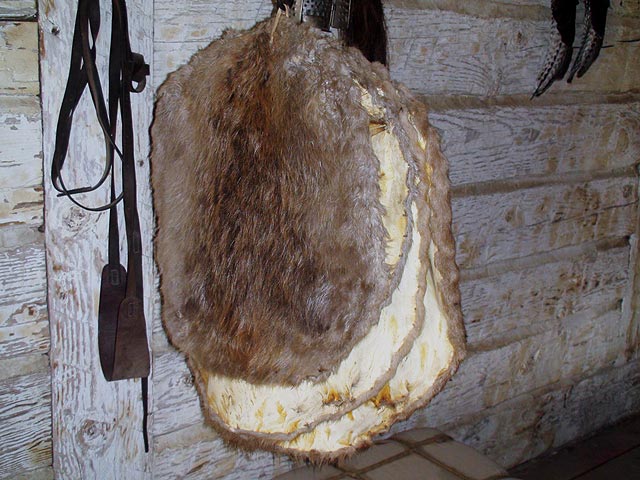 | |||
| Beaver pelts, photographed at Fort Buford. Source: Thomet Daniel 2010. | |||
| 1630 | When the first Dutch established settlements along the Connecticut River, Podunk Indians lived in the Connecticut Valley, especially in what is now Hartford County. | Podunk (River Indians) | - |
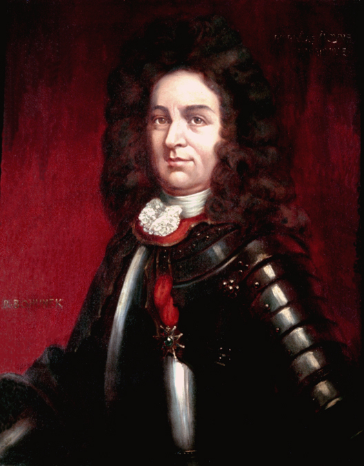
| Summer 1632 | The Dutch captured the Grand Sachem of the Pequot, Tatobam. They demanded a ransom from the Pequot, which they paid. Nevertheless, the Dutch killed Tatobam. His son Sassacus became Grand Sachem of the Pequot. | Pequot Pequot | Sassacus Tatobam |
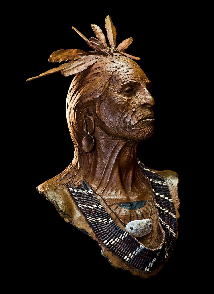 | |||
| Sassacus, Pequot Sachem. Source: Antiques.com | |||
| July 1633 | On June 8, 1633, the Dutch West India Company (WIC) under the leadership of Jacob van Curler purchased land near present-day Hartford (Connecticut) from the Wangunk Indians ('River Indians') under Sachem Sequassen and established a fortified trading post. The trading post was given the name 'House of Good Hope'. A small troop from New Amsterdam with two small cannons formed the garrison of the small fort. | Wangunk (River Indians) | Sequassen |
 | |||
| House of Good Hope near Hartford, Connecticut. Source: http://www.living-in-the-past.com/Icrannogwebpage5.html | |||
| September 1633 | The Plymouth Colony established a trading post with 70 soldiers under the leadership of Captain William Holmes near the present-day village of Windsor (north of Hartford), about 1-2 miles north of the Dutch trading post 'House of good hope'. This trading post was called 'Matianuck'. The Dutch responded and also sent 70 men to the new trading post. However, due to the fortification of the new English trading post, the Dutch refrained from attacking. The Podunk sachems Waghinnicut, Arramament and Natawanute sold the settlers from Plymouth the land they needed. | Podunk (River Indians) Podunk (River Indians) Podunk (River Indians) | Waghinnicut Natawanute Arramament |
| 1633 | A smallpox epidemic caused by the Dutch in Connecticut reduced the number of Pequot from 8,000 to about 4,000 and that of the Narragansett to about 700. Many other tribes were also decimated, such as the Podunk (River Indians) under Sachem Natawanute. John Sassamon's Wampanoag parents also died. | Pequot Podunk (River Indians) Pokanoket (Wampanoag) Narragansett | Natawanute John Sassamon |
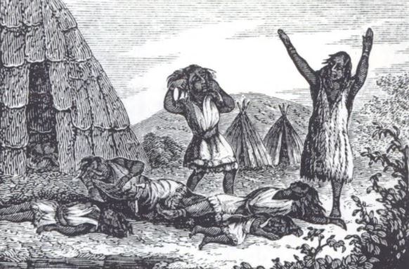 | |||
| The epidemic of 1633 drastically reduced the Indian population in New England (Massachusetts, Connecticut, Rhode Island). Source: http://www.newenglandhistoricalsociety.com/exactly-new-englands-indian-population-nearly-wiped/ | |||
| Middle of May 1637 | Battle of Mystic-River 1637 - A Dutch ship anchored just above the mouth of the Thames. There the Dutch captured seven Pequot from the nearby village under Chief Sassacus and exchanged them for two English girls who had been captured during the attack on Wethersfield, both daughters of a certain Abraham Swain. The Dutch immediately brought the two girls back to Fort Saybrook. There the Dutch encountered the small army of John Mason. | Pequot | Sassacus |
| 1643 | In 1643, 13 different Indian groups lived on Long Island. Various Lenape groups lived in the west of the peninsula and various Algonquin Indians in the east. The first Europeans reported that the Indians lived in round grass huts with a diameter of 3 to 7 meters. The Indians also helped the settlers by teaching them how to hunt, fish and grow corn, which enabled the settlers to survive in the new environment. The English generally treated the Indians fairly. Not so the Dutch, who repeatedly killed Indians. The problems with the Dutch and a smallpox epidemic in 1658 were the reason why the Indians gradually left Long Island. The last Canarsie Indian died around 1800. https://awalkthroughflushing.wordpress.com/2014/12/17/24/. http://blog.nmai.si.edu/main/2011/08/americas-first-urban-myth.html. https://de.wikipedia.org/wiki/Merrick_(people). | Canarsie (Lenape) Rockaway Matinecock (Algonquin) Merrick (Algonquin) Massapequa Nissequoge Secatoag Seatauket Patchoag Corchaug (Algonquin) Shinnecock Manhaset Montauk (Algonquin) | Canarsie Rockaway Matinecock Merrick Massapequa Nissequoge Secatoag Seatauket Patchoag Corchaug Shinnecock Manhasset Montauk |
| 1645 | Two-Row-Wampum Treaty 1645In this treaty, the Iroquois were granted an intermediate trade monopoly in the fur trade. In 1648, the war between the Iroquois and the Hurons escalated. The Oneida closed the Ottawa River and thus the Huron trade route for the fur trade. The Iroquois also advanced north to the St. Lawrence River in order to isolate the Hurons here as well. However, these attempts failed. | Oneida (Iroquois) Iroquois | - |
| 1660 | The colony of New Holland was an important power factor in North America under its Governor General Peter Stuyvesand. Strong immigration caused the population to grow from 2,500 to around 9,000 between 1645 and 1664. In 1655, they conquered a base established by the Swedes on the Delaware River. | - | - |
| 1663 | The Pocumtuc (Abenaki) unsuccessfully attacked a village of the eastern Mohawk. The Pocumtuc then asked the Dutch and Mahican to make peace with the Mohawk, but were unsuccessful. | Pocumtuc Mohawk (Iroquois) Mahican | - |
| 27 August 1664 | Pilgrims 1620-1676 - After the Dutch navy had suffered its last defeat in Europe at the hands of the English, King Charles II of England commissioned Richard Nicolls to take over the Dutch colonies in New England. Nicolls sailed to New Amsterdam with four ships. New Holland on the Hudson River was taken over by the English under Richard Nicolls without a fight. At this time, New Holland was governed by Peter Stuyvesant. With the transfer to the English, the Iroquois had a new neighbor, but the Dutch traders continued to control the fur trade. This takeover led to the Second Anglo-Dutch War. In the Third Anglo-Dutch War, the Dutch recaptured New Amsterdam and the city was renamed 'New Orange'. With the Treaty of Westminster in 1874, 'New Orange' fell back to England and was renamed 'New York'. At that time, around 270 people lived in New Amsterdam. | Iroquois | - |
| Beginn 1698 | D'Ibervilles first Louisiana Expedition 1699 - The French noticed that the English and Dutch were planning to establish colonies in what is now the state of Louisiana. The French Minister of the Navy, Count de Pontchartrain, convinced King Louis XIV that a French colony should be founded in Louisiana as soon as possible. The Minister of the Navy selected Pierre de Moyne d'Iberville for this task. | - | - |
 | |||
| Pierre de Moyne d'Iberville. Source: https://www.knowlouisiana.org | |||
| 1707 | Hendrick van Rensselaer built the house known today as 'Fort Crailo' or 'Yankee Doodle House' on the east bank of the Hudson River opposite Albany. The British army repeatedly took advantage of the ideal location of the large building and accommodated many soldiers from the surrounding area. From Crailo House, troops could march north to the Lake George / Lake Champlain region or west to the Mohawk Valley. | - | - |